

Britain is experiencing its third heatwave of the summer, with temperatures expected to reach 30°C across large swathes of the country today and potentially climb even higher on Sunday, the Met Office has confirmed.
The forecaster has warned that “large swathes of the UK have met heatwave criteria” as the hot, dry and sunny weather continues throughout the weekend, with eastern England potentially seeing temperatures exceed 31°C.
Saturday’s forecast shows another “widely hot day” with plenty of sunshine and light winds, though eastern coastal areas may experience slightly cooler conditions due to increased cloud cover.
Met Office Chief Meteorologist Matthew Lenhardt said the heatwave conditions would persist through the weekend before a potential breakdown early next week. “A very warm evening, with plenty of sunshine ahead of dusk. Dry and clear for most overnight with some locally high temperatures, making it feel rather muggy,” he stated in today’s forecast.
The current heatwave marks the third such event this summer, following extreme heat episodes in June that saw England record its warmest June on record with a mean temperature of 16.9°C.
Health Warnings Issued
The UK Health Security Agency (UKHSA) has issued yellow Heat Health Alerts covering England, valid until Tuesday 15 July. The warnings cover the Midlands, South and East England, Yorkshire and Humber, and London.
A yellow alert indicates that heat could pose health risks for vulnerable people, including the elderly and those with underlying health conditions. The alert system, which has been in place since 2004, serves as an early warning for health and social care professionals.
Dr Nick Dunstone, Met Office Science Fellow, warned about the extended nature of this heatwave: “This hot spell is forecast to last longer and cover a broader area than previous ones so far this summer and affect areas further north and west.”
The Met Office has advised that pollen and UV levels will be “very high” in some areas during the heatwave period.
Sunday’s Outlook
Sunday is forecast to bring the peak of the current heatwave, with temperatures potentially reaching 31°C in southeast England. Scotland is also expected to meet heatwave criteria over the weekend, marking a more widespread heat event than previous episodes this summer.
“Sunday will be another hot day quite widely across the southern half of the UK,” Lenhardt explained. However, he noted a marked difference in northwestern parts of the UK, where cloud and heavy rain will affect Northern Ireland and western Scotland, suppressing temperatures to the mid to high teens.
The Met Office warned of potential “tropical nights” in some locations, where temperatures may not drop below 20°C. “These sorts of temperatures make it hard to sleep and prevent any recovery from the high daytime temperatures,” officials noted.
Breaking Down Next Week
Meteorologists predict the heatwave will begin to break down from Sunday evening into Monday, with fresher air moving in from the west. “Gradually turning cooler and cloudier on Sunday and Monday with the risk of some showers and thunderstorms in places,” the forecast states.
The breakdown is expected to bring a sharp contrast to the weekend’s conditions, with the potential for heavy rainfall and thunderstorms in some areas as cooler Atlantic air displaces the hot continental air mass.
Jim Dale, meteorologist for British Weather Services, said: “We could see highs of 31°C to 34°C at some point, depending on when a front comes through. With this, there will be building humidity with the hottest temperatures the further west and southwest you go.”
Climate Change Context
The current heatwave comes as Met Office scientists published new research revealing that the chance of exceeding 40°C in the UK is “accelerating at pace” and is now over 20 times more likely than in the 1960s.
Dr Gillian Kay, Senior Scientist at the Met Office, stated: “We estimate a 50-50 chance of seeing a 40°C day again in the next 12 years. We also found that temperatures several degrees higher than we saw in July 2022 are possible in today’s climate.”
The UK first recorded a temperature above 40°C in July 2022, when Coningsby in Lincolnshire reached 40.3°C. That summer saw close to 3,000 heat-related excess deaths in England, according to UKHSA data.
Marine Heatwave
Adding to concerns, seas to the south of the UK are experiencing a significant marine heatwave, with water temperatures reaching as high as 20°C in some places. The Met Office expects these conditions to persist and intensify over the coming week.
However, temperatures around the coasts of Northern Ireland and northern Britain remain notably cooler, creating a stark contrast in marine conditions around the British Isles.
Public Safety Advice
The RNLI has issued water safety warnings alongside the heat alerts. Ross Macleod, Water Safety Manager, cautioned: “Even in hot weather, the seas around our coasts are cold enough year-round to trigger cold water shock, while waves and rip currents can overpower even the most experienced water users.
Health officials have reminded the public to stay hydrated, keep out of the sun during the hottest parts of the day between 11am and 3pm, and check on vulnerable neighbours and relatives.
The government’s “beat the heat” guidance emphasises staying in shade, wearing sunscreen, and recognising signs of heat exhaustion and heatstroke.
Looking Ahead
While the immediate forecast shows hot conditions continuing through the weekend, meteorologists are closely monitoring the developing weather patterns for next week.
The Met Office’s longer-range forecast suggests changeable conditions will return, with periods of fine weather interspersed with more unsettled intervals bringing showers or longer spells of rain, some potentially heavy with thunderstorms.
Temperatures are expected to remain above normal for the majority of the UK throughout July, with the potential for further hot spells, particularly in southern and eastern areas.
As extreme weather events become more frequent due to climate change, the Met Office continues to monitor and analyse temperature trends to provide accurate forecasts and timely warnings, helping communities prepare for and adapt to changing climate conditions.
Follow for more updates on Britannia Daily
Britain is experiencing its third heatwave of the summer, with temperatures expected to reach 30°C across large swathes of the country today and potentially climb even higher on Sunday, the Met Office has confirmed.
The forecaster has warned that “large swathes of the UK have met heatwave criteria” as the hot, dry and sunny weather continues throughout the weekend, with eastern England potentially seeing temperatures exceed 31°C.
Saturday’s forecast shows another “widely hot day” with plenty of sunshine and light winds, though eastern coastal areas may experience slightly cooler conditions due to increased cloud cover.
Met Office Chief Meteorologist Matthew Lenhardt said the heatwave conditions would persist through the weekend before a potential breakdown early next week. “A very warm evening, with plenty of sunshine ahead of dusk. Dry and clear for most overnight with some locally high temperatures, making it feel rather muggy,” he stated in today’s forecast.
The current heatwave marks the third such event this summer, following extreme heat episodes in June that saw England record its warmest June on record with a mean temperature of 16.9°C.
Health Warnings Issued
The UK Health Security Agency (UKHSA) has issued yellow Heat Health Alerts covering England, valid until Tuesday 15 July. The warnings cover the Midlands, South and East England, Yorkshire and Humber, and London.
A yellow alert indicates that heat could pose health risks for vulnerable people, including the elderly and those with underlying health conditions. The alert system, which has been in place since 2004, serves as an early warning for health and social care professionals.
Dr Nick Dunstone, Met Office Science Fellow, warned about the extended nature of this heatwave: “This hot spell is forecast to last longer and cover a broader area than previous ones so far this summer and affect areas further north and west.
The Met Office has advised that pollen and UV levels will be “very high” in some areas during the heatwave period.
Sunday’s Outlook
Sunday is forecast to bring the peak of the current heatwave, with temperatures potentially reaching 31°C in southeast England. Scotland is also expected to meet heatwave criteria over the weekend, marking a more widespread heat event than previous episodes this summer.
“Sunday will be another hot day quite widely across the southern half of the UK,” Lenhardt explained. However, he noted a marked difference in northwestern parts of the UK, where cloud and heavy rain will affect Northern Ireland and western Scotland, suppressing temperatures to the mid to high teens.
The Met Office warned of potential “tropical nights” in some locations, where temperatures may not drop below 20°C. “These sorts of temperatures make it hard to sleep and prevent any recovery from the high daytime temperatures,” officials noted.
Breaking Down Next Week
Meteorologists predict the heatwave will begin to break down from Sunday evening into Monday, with fresher air moving in from the west. “Gradually turning cooler and cloudier on Sunday and Monday with the risk of some showers and thunderstorms in places,” the forecast states.
The breakdown is expected to bring a sharp contrast to the weekend’s conditions, with the potential for heavy rainfall and thunderstorms in some areas as cooler Atlantic air displaces the hot continental air mass.
Jim Dale, meteorologist for British Weather Services, said: “We could see highs of 31°C to 34°C at some point, depending on when a front comes through. With this, there will be building humidity with the hottest temperatures the further west and southwest you go.”
Climate Change Context
The current heatwave comes as Met Office scientists published new research revealing that the chance of exceeding 40°C in the UK is “accelerating at pace” and is now over 20 times more likely than in the 1960s.
Dr Gillian Kay, Senior Scientist at the Met Office, stated: “We estimate a 50-50 chance of seeing a 40°C day again in the next 12 years. We also found that temperatures several degrees higher than we saw in July 2022 are possible in today’s climate.”
The UK first recorded a temperature above 40°C in July 2022, when Coningsby in Lincolnshire reached 40.3°C. That summer saw close to 3,000 heat-related excess deaths in England, according to UKHSA data.
Marine Heatwave
Adding to concerns, seas to the south of the UK are experiencing a significant marine heatwave, with water temperatures reaching as high as 20°C in some places. The Met Office expects these conditions to persist and intensify over the coming week.
However, temperatures around the coasts of Northern Ireland and northern Britain remain notably cooler, creating a stark contrast in marine conditions around the British Isles.
Public Safety Advice
The RNLI has issued water safety warnings alongside the heat alerts. Ross Macleod, Water Safety Manager, cautioned: “Even in hot weather, the seas around our coasts are cold enough year-round to trigger cold water shock, while waves and rip currents can overpower even the most experienced water users.
Health officials have reminded the public to stay hydrated, keep out of the sun during the hottest parts of the day between 11am and 3pm, and check on vulnerable neighbours and relatives.
The government’s “beat the heat” guidance emphasises staying in shade, wearing sunscreen, and recognising signs of heat exhaustion and heatstroke.
Looking Ahead
While the immediate forecast shows hot conditions continuing through the weekend, meteorologists are closely monitoring the developing weather patterns for next week.
The Met Office’s longer-range forecast suggests changeable conditions will return, with periods of fine weather interspersed with more unsettled intervals bringing showers or longer spells of rain, some potentially heavy with thunderstorms.
Temperatures are expected to remain above normal for the majority of the UK throughout July, with the potential for further hot spells, particularly in southern and eastern areas.
As extreme weather events become more frequent due to climate change, the Met Office continues to monitor and analyse temperature trends to provide accurate forecasts and timely warnings, helping communities prepare for and adapt to changing climate conditions.
Follow for more updates on Britannia Daily
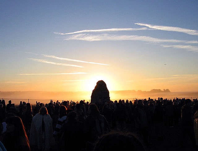
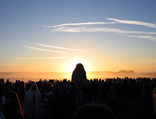
Image Credit:
Sun behind the Heel Stone – Photo by Jim Champion, licensed under CC BY-SA 2.0, via Wikimedia Commons.