


Thousands of Alaskans scrambled for higher ground on Wednesday after a powerful 7.3 magnitude earthquake struck off the coast, triggering tsunami warnings across a 700-mile stretch of the state’s southern coastline.
The massive quake hit at 12:37 p.m. local time, centred 54 miles south of Sand Point, a remote fishing community of 600 people on Popof Island in the Aleutian chain, according to the US Geological Survey.
Emergency sirens wailed across coastal communities as the National Weather Service declared a tsunami “imminent” at 1 p.m. local time, ordering immediate evacuations in Sand Point, Cold Bay, Kodiak, and numerous other settlements along the Alaska Peninsula.
I was at home for lunch and the house was shaking and things were falling, and cupboard doors were coming open,” Sand Point city administrator Debi Schmidt told local media. “It was the biggest one I’ve ever felt.”
The US Coast Guard evacuated personnel from its Kodiak base to higher ground and launched two air crews on standby to assist. In Homer, bumper-to-bumper traffic clogged roads as residents fled the Homer Spit, a popular tourist area jutting into Kachemak Bay.
Dramatic social media footage showed water receding from coastlines—a telltale sign of an approaching tsunami—as panicked residents documented their evacuations on platforms including Snapchat. Radio stations interrupted broadcasts with urgent evacuation orders.
The National Tsunami Warning Center initially forecast waves of up to one foot would strike Sand Point shortly after 1 p.m., followed by Cold Bay at 2:30 p.m. and Kodiak at 2:40 p.m. local time.
However, the feared destructive waves never materialised. A buoy near Sand Point recorded only a 0.2-foot rise—approximately three inches—prompting authorities to downgrade the warning to an advisory about an hour later.
We have seen other earthquakes in the area that have not generated significant tsunami waves, but we’re treating it seriously,” said Jeremy Zidek, spokesperson for Alaska’s emergency management division. “We’re making sure communities are notified so they can activate their evacuation procedures.”
By 2:45 p.m. local time, the National Tsunami Warning Center cancelled all warnings and advisories. “A tsunami was generated by this event, but no longer poses a threat,” the centre announced. “Some areas may continue to see small sea level changes.”
The earthquake was felt as far away as Anchorage, nearly 600 miles northeast of the epicentre, and Juneau, where residents reported light shaking. In Sand Point, objects flew from pantry shelves, whilst Homer residents described “mild rolling” with swaying lamps and plants.
At least 40 aftershocks rattled the region within three hours of the initial quake, the largest measuring magnitude 5.2, according to the Alaska Earthquake Center. Officials warned aftershocks would likely persist for days or weeks.
The entire southern coast of Alaska is a gigantic earthquake zone,” explained Dr Michael West, seismologist with the Alaska Earthquake Center. “Four out of five earthquakes in the United States happen in Alaska.”
The region has experienced remarkable seismic activity in recent years, with Wednesday’s tremor marking the fifth earthquake exceeding magnitude 7 since 2020. “Something’s moving in this area,” West noted. “I would not call this an isolated earthquake. It appears to be part of a larger sequence spanning the last several years.”
Emergency shelters opened across the affected region. In Kodiak, authorities directed residents living below 100 feet elevation to evacuate to the high school and an elementary school. King Cove officials ordered coastal residents to move inland, whilst Unalaska authorities told citizens to reach at least 50 feet above sea level or move a mile inland.
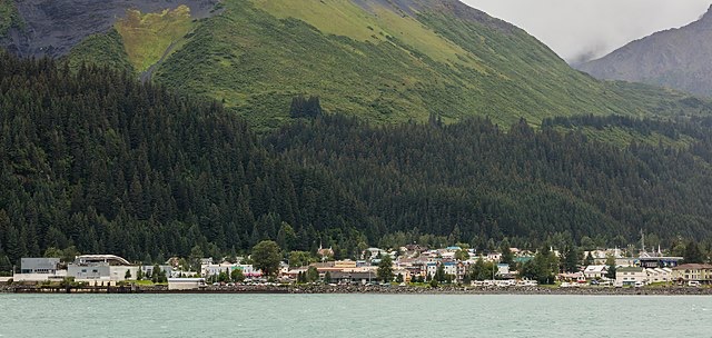
Tourists at the Alaska SeaLife Center in Seward found themselves caught in the evacuation. “We were looking at the puffins when someone yelled that there had been an earthquake and we needed to evacuate,” said visitor Jodie Stevens. We walked a few blocks uphill in the rain, with a woman from the centre yelling to those we passed to get to higher ground.
The quake struck at a depth of approximately 12 miles, resulting from strike-slip faulting near the subduction zone interface between the Pacific and North America tectonic plates, according to USGS analysis.
Alaska’s earthquake-prone southern coast sits along the infamous Ring of Fire, where tectonic plates meet. The region experienced one of history’s most powerful earthquakes in 1964, when a magnitude 9.2 tremor devastated Anchorage and triggered tsunamis that killed more than 130 people.
Wednesday’s earthquake occurred within the aftershock zone of the July 2020 magnitude 7.8 Simeonof Earthquake, suggesting ongoing instability in the region. Seismologists warned that based on historical patterns, at least one magnitude 6 or greater aftershock remains possible within the coming week.
No significant damage or injuries were immediately reported, though authorities continued assessing remote communities throughout Wednesday evening.
Follow for more updates on Britannia Daily
Image Credit:
Seward, Alaska, United States, 2017-08-21 – Photo by Diego Delso, licensed under CC BY-SA 4.0, via Wikimedia Commons.
View Image