


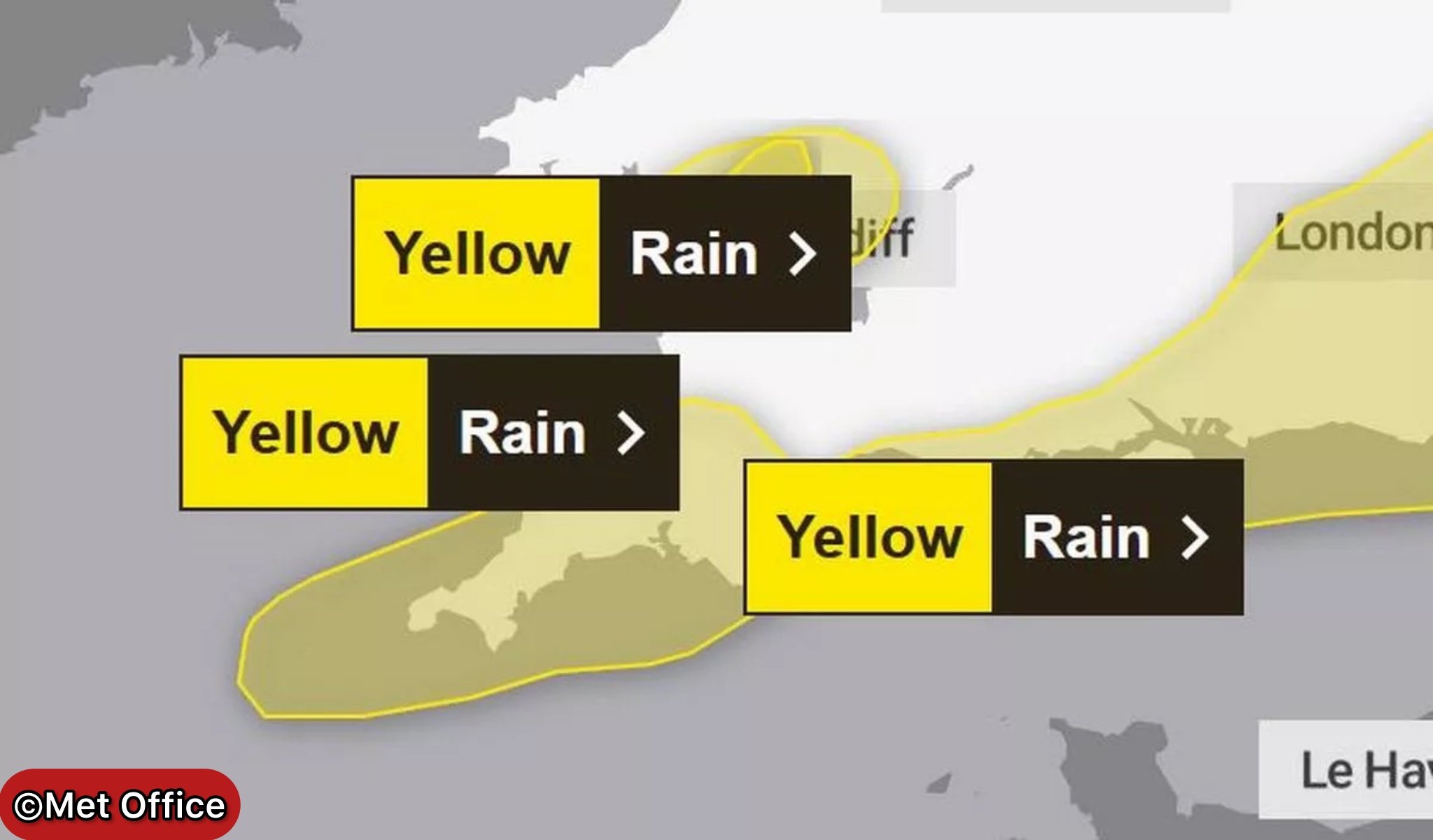
The Met Office has issued yellow weather warnings for rain across large swathes of the UK as meteorological summer ends with unsettled conditions that could bring flooding and travel disruption.
Two separate weather warnings are in effect, with South Wales already experiencing heavy downpours this morning and much of southern England bracing for prolonged rainfall from tonight. The warnings come as a westerly weather regime takes hold, marking a significant shift from the dry conditions experienced throughout much of August.
The first warning, covering parts of South Wales including Bridgend, Merthyr Tydfil, Neath Port Talbot, Powys, Rhondda Cynon Taf and Swansea, came into effect at 7.56am and will remain in place until 4pm today. Frequent heavy showers are expected to continue through the morning and early afternoon before gradually easing later.
Overnight Warning for Southern England
A second, more extensive yellow warning will come into force at 10pm tonight, covering the east of England, London, South East England, South West England and Wales. This warning will remain active until midday on Friday as heavy showers and longer spells of rain sweep across southern counties.
The Met Office warned that bus and train services are likely to be affected with longer journey times, whilst spray and flooding on roads could create hazardous driving conditions. The weather agency also cautioned that flooding of “a few homes and businesses” is likely in the worst-affected areas.
“Heavy showers, perhaps merging into longer spells of heavy rain at times, are likely to reach southwest England and south Wales Thursday night, before pushing quickly east to affect other parts of southern and southeastern England into Friday morning,” the Met Office stated.
Potential for Significant Rainfall
Whilst not all areas will experience the heaviest downpours, the Met Office warned that 10-20mm of rain could fall in less than an hour where showers do occur. More concerning is the potential for 50-70mm of rain in a few hours where heavy showers become prolonged, particularly near coastal areas.
Some flooding in these wetter areas is possible. A few showers could be accompanied by the odd rumble of thunder, again this more likely near to coasts,” forecasters added. The heavy rain should clear into the North Sea by early Friday afternoon.
Met Office Chief Meteorologist Steve Willington explained the changing weather pattern: “A westerly regime is now in charge of the UK’s weather and will help fuel periods of wet and windy weather over the next few days, with showers and some longer spells of rain likely for much of the UK on Thursday and Friday.
Welcome Relief After Dry Spell
Whilst the rain may prove disruptive, Mr Willington acknowledged it could be welcome in some areas. While many areas may welcome some rain after fairly prolonged dry weather, there’s a potential that over the next few days some parts of Wales, northwest England and western Scotland could see some impacts at times, which we’ll be keeping an eye on.
The unsettled conditions mark a dramatic shift from the hot, dry weather that has characterised much of summer 2025. Monday’s bank holiday saw temperatures reach 29.1°C in Hawarden, Flintshire, putting the UK on track for what could be its hottest summer on record.
Weekend Outlook Remains Unsettled
Looking ahead to the weekend, conditions are set to deteriorate further as a deep area of low pressure moves in from the southwest. The Met Office forecast warns of more prolonged and heavy rain on Saturday, accompanied by strong winds particularly along coastal areas.
Deputy Chief Meteorologist David Oliver, responsible for medium-range forecasting, warned: “A deep area of low pressure will develop close to the UK on Saturday and track northeast over the weekend, bringing wet and windy weather for many.
He added: “While the exact track and depth of the system is still a little uncertain, at present it looks likely that we’ll see gusts in excess of 50mph in some areas during Saturday and Sunday, especially across coasts, headlands and high ground.”
North West Escapes Warnings
Whilst the Met Office has not placed the north west under any weather warnings, the region is not expected to escape the unsettled conditions entirely. The forecast for Friday predicts “heavy and thundery showers” with temperatures holding around the late August average of 20°C during sunnier intervals.
The outlook for the weekend in the northwest suggests “more prolonged rain on Saturday, accompanied by strong winds. Then a return to sunshine and blustery showers on Sunday and Monday. Feeling rather cool amongst the rain and brisk winds.”
Safety Advice for Heavy Rain
The Met Office has urged people to check if their property could be at risk of flooding and consider preparing a flood plan and emergency kit. Motorists are advised to check road conditions before travelling and allow extra time for journeys.
Those using public transport should check timetables as services are likely to be disrupted. The weather service also recommends giving yourself extra time and driving to conditions if travelling, as spray and sudden flooding could lead to difficult driving conditions and some road closures.
With changeable and unsettled conditions expected to continue into next week, the UK appears to be transitioning firmly into autumn weather patterns. Low pressure systems are forecast to dominate, bringing further showers and longer spells of rain, with the heaviest rainfall likely in western areas.
Follow for more updates on Britannia Daily