


Storm Floris will unleash unseasonably strong winds of up to 85mph across northern Britain from Monday, prompting the Met Office to issue a yellow weather warning covering Scotland, Northern Ireland, northern England and north Wales.
The sixth named storm of the 2024/2025 season threatens widespread disruption to transport networks, with potential damage to buildings and danger to life from flying debris. The warning takes effect from 6am Monday 4 August until 6am Tuesday 5 August 2025.
Matthew Lehnert, Met Office Chief Meteorologist, said: “Across the warning area, many inland areas are likely to see gusts of 40-50mph, with 60-70mph more likely at higher elevations and around exposed coasts in Scotland. There is a small chance that some locations here could even record gusts of 85mph.”
Extreme Winds to Hit Scottish Coastlines
Scotland faces the brunt of Storm Floris, with the strongest winds expected during Monday afternoon and night. Exposed Scottish coastlines and hills could see gusts reaching 85mph, whilst inland areas may experience winds of 60-70mph.
The Met Office warned that there remains some uncertainty in the depth and track of Floris, though meteorologists expect conditions to deteriorate rapidly as the storm moves across the northern half of the UK.
Winds will first ease in the west during later Monday but remaining very strong overnight until early Tuesday in the east, forecasters said. Heavy rain accompanying the storm system will compound the disruption across affected regions.
Transport Networks Brace for Major Disruption
Travel chaos appears inevitable as Storm Floris approaches, with road, rail, air and ferry services all facing potential cancellations and delays. The Met Office specifically warned that longer journey times should be expected across all transport modes.
Railway operators have begun preparations for the storm’s impact. Network Rail teams stand ready to respond to fallen trees and overhead wire damage, with services likely to face speed restrictions or suspensions during the worst conditions.
Ferry services across Scotland’s west coast, including CalMac routes, face likely disruptions given the forecast wind speeds. The operator has advised passengers to check service status before travelling, as exposed routes may require cancellation at short notice.
Buildings and Infrastructure at Risk
The Met Office has warned residents in affected areas to prepare for potential structural damage. Loose items outside your home including bins, garden furniture, trampolines, tents, sheds and fences should be secured ahead of the storm’s arrival.
Power cuts remain a significant concern, with authorities advising households to prepare emergency supplies including torches, batteries and mobile phone power packs. People cope better with power cuts when they have prepared for them in advance, the Met Office noted.
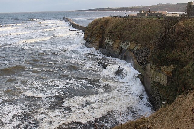
Coastal communities face particular dangers from Storm Floris. The Met Office urged extreme caution near shorelines, warning that large breaking waves can sweep you off your feet and out to sea. Dog walkers were specifically advised to keep pets on leads when walking near cliffs.
Unseasonable Summer Storm Follows Quiet Period
Storm Floris marks an unusual meteorological event for August, though summer storms are not unprecedented in the UK. The system arrives following a relatively calm weekend forecast of sunshine and showers.
Storm Floris is the sixth named storm of the 2024/2025 Storm Naming season, which runs from September to August each year. Storm Éowyn – which occurred in late January – was the last named storm to affect the UK, causing significant disruption to transport networks at the time.
The Met Office collaborates with Met Éireann and the Royal Netherlands Meteorological Institute to name storms when they pose potential for disruption or damage. This naming system, operational since 2015, aims to improve public awareness and communication during severe weather events.
Emergency Services on High Alert
Emergency services across northern Britain have activated severe weather protocols ahead of Storm Floris’s arrival. The Met Office advised anyone in coastal areas experiencing emergencies to call 999 and ask for the Coastguard.
Local authorities have begun implementing precautionary measures, including checking drainage systems and preparing response teams for fallen trees and debris clearance. Schools and public facilities in the warning zone may face closures depending on local conditions.
Expert Analysis Points to Climate Patterns
Meteorologists note that whilst summer storms occur periodically, the intensity of Storm Floris raises questions about changing weather patterns. The storm’s development follows a period of unsettled Atlantic conditions creating the perfect environment for rapid cyclone formation.
Weather experts emphasise that residents should not underestimate the storm due to its summer timing. Historical data shows that some of the UK’s most damaging storms have occurred outside traditional winter months.
The Met Office continues to monitor Storm Floris’s development closely, with updates available through their website, mobile app and social media channels. Forecasters warn that weather warnings may change quickly as the storm approaches.
Looking Ahead: Recovery Planning Begins
Transport operators have already begun planning for post-storm recovery operations. Previous storms have demonstrated that clearing fallen trees and repairing infrastructure can take several days, potentially extending disruption beyond the warning period.
The agricultural sector faces concerns about crop damage from the unseasonable winds, particularly in Scotland’s exposed farmland. Industry representatives advise farmers to secure equipment and livestock ahead of Monday’s deteriorating conditions.
As Storm Floris approaches, authorities stress the importance of heeding official warnings and avoiding unnecessary travel during the storm’s peak. The combination of extreme winds, heavy rain and summer holiday traffic creates particularly hazardous conditions requiring public vigilance.
Follow for more updates on Britannia Daily
Image Credit:
This is a licensed photograph from Geograph Britain & Ireland:
- North Sea Storm – English description: North Sea Storm – geograph.org.uk – 6367798.jpg, photographer user ID unknown (via Geograph Project), image taken on an unspecified date, licensed under Creative Commons Attribution‑ShareAlike 2.0 Generic (CC BY‑SA 2.0)